
For land surveying & drone lidar mapping
Custom AI tools for land surveyors and drone mappers.
Instant acreage/boundary survey estimators, deed & plat PDF readers, and off-road pin navigation with FracPin.com. Built, hosted, and maintained for you by Sandbox Synergy—starting at $297 setup + $79/mo for solo startups or $797 + $197/mo for growing teams.
Live branded preview in 60 seconds below · No sales call required


What we fix first
Zero missed land surveying & drone lidar mapping calls
While your hands are busy on the job, your 24/7 AI Receptionist answers every call and text in under 10 seconds and captures parcel acreage, boundary corner count, survey type (ALTA/NSPS commercial, rural boundary/stakeout, topo, or drone LiDAR photogrammetry), and deed status.
30-second land surveying & drone lidar mapping quotes
Customers answer 4 trade-specific questions (ALTA/NSPS commercial land title survey, rural acreage boundary & fence-line staking, ...) to see your Good/Better/Best price and pay their deposit in one tap.
6:00 AM daily land surveying & drone lidar mapping leads
Wake up every morning to de-duplicated prospects pulled from County Rural Acreage & Commercial Escrow Title Company Survey Order Feed and Municipal Subdivision Plat, Civil Engineering & Excavation Contractor Network.
What's included
The tools we'd build for you.
Instant Quote Calculator
Visitors answer 3–4 quick questions on your website and see a price estimate instantly.
24/7 Chat & Phone Receptionist
An always-on helper that answers common questions and books appointments day or night.
Custom Lead Finder
You tell us who your ideal customers are and where to look. Every morning it finds fresh matches — local businesses, companies hiring, new permits and filings, or sites you name — with contact details when available.
Automatic Text & Email Follow-Up
Polite follow-ups go out to missed callers, open quotes and unpaid invoices on their own.
Online Payments & Customer Login
A secure page with your logo where customers approve work, upload files and pay invoices in one tap.
Live Jobs & Crew Map
An interactive map of your jobs, properties or crews with one-tap driving directions.
How it works
- 01
Answer a short survey about your business and what slows you down.
- 02
See your plan, timeline and price — then a private preview within 72 hours.
- 03
Launch in about three weeks. We host, maintain and keep improving it.
System Spec30-Second Quote Intake & 6:00 AM Lead Sources for Land surveying & drone LiDAR mapping▼
sampleQuoteFlow · 4-Step Intake
1. Which land surveying & drone lidar mapping service or package do you need quoted?
Options: ALTA/NSPS commercial land title survey, rural acreage boundary & fence-line staking, construction foundation/rough-grade staking, or RTK drone LiDAR volumetric stockpile & topo mapping
Logic: Selects the exact service template, crew/specialist duration, and minimum call-out or base fee for land surveying & drone lidar mapping.
2. What are the job specifications (parcel acreage, boundary corner count, survey type (ALTA/NSPS commercial, rural boundary/stakeout, topo, or drone LiDAR photogrammetry), and deed status)?
Options: Interactive selector for parcel acreage, boundary corner count, survey type (ALTA/NSPS commercial, rural boundary/stakeout, topo, or drone LiDAR photogrammetry), and deed status plus optional 1-tap smartphone photo or document upload.
Logic: Applies your custom Good / Better / Best tiered pricing table calibrated to parcel acreage, boundary corner count, survey type (ALTA/NSPS commercial, rural boundary/stakeout, topo, or drone LiDAR photogrammetry), and deed status to calculate an instant, accurate ballpark range in 30 seconds.
3. What are the site access, location, or compliance conditions?
Options: Site/property access, location zip code, and photo upload of current condition for land surveying & drone lidar mapping
Logic: Automatically factors in travel radius, equipment access, or code compliance requirements so margins stay protected.
4. How soon do you need this scheduled and how would you like to lock in your slot?
Options: Same-day/emergency priority slot, standard 48-hour booking window, or recurring service schedule for land surveying & drone lidar mapping
Logic: Matches live calendar availability, collects a 1-tap booking deposit, and dispatches confirmation via SMS.
dailyLeadSources · 6:00 AM Engine
- 01. County Rural Acreage & Commercial Escrow Title Company Survey Order Feed
- Signal: Daily 6:00 AM scan of newly recorded filings, permits, and active service triggers for land surveying & drone lidar mapping (ALTA/NSPS commercial land title survey, rural acreage boundary & fence...)
- Fields: Verified owner/decision-maker name, property/facility address, direct phone/email, and land surveying & drone lidar mapping trigger date
- 02. Municipal Subdivision Plat, Civil Engineering & Excavation Contractor Network
- Signal: Active local commercial accounts, partner referrals, and territory opportunities requiring land surveying & drone lidar mapping
- Fields: Key contact person, organization/parcel profile, service territory zip code, and active project or referral volume
- 03. FracPin.com Live Field & Territory Intelligence Feed (Land surveying & drone LiDAR mapping)
- Signal: Daily 6:00 AM commercial, municipal, and regional demand signals matched to Land Surveyors, Drone Photogrammetry & Construction Staking
- Fields: GPS pin coordinates, decision-maker contact details, territory heat score, and 1-tap outreach readiness
Built by us
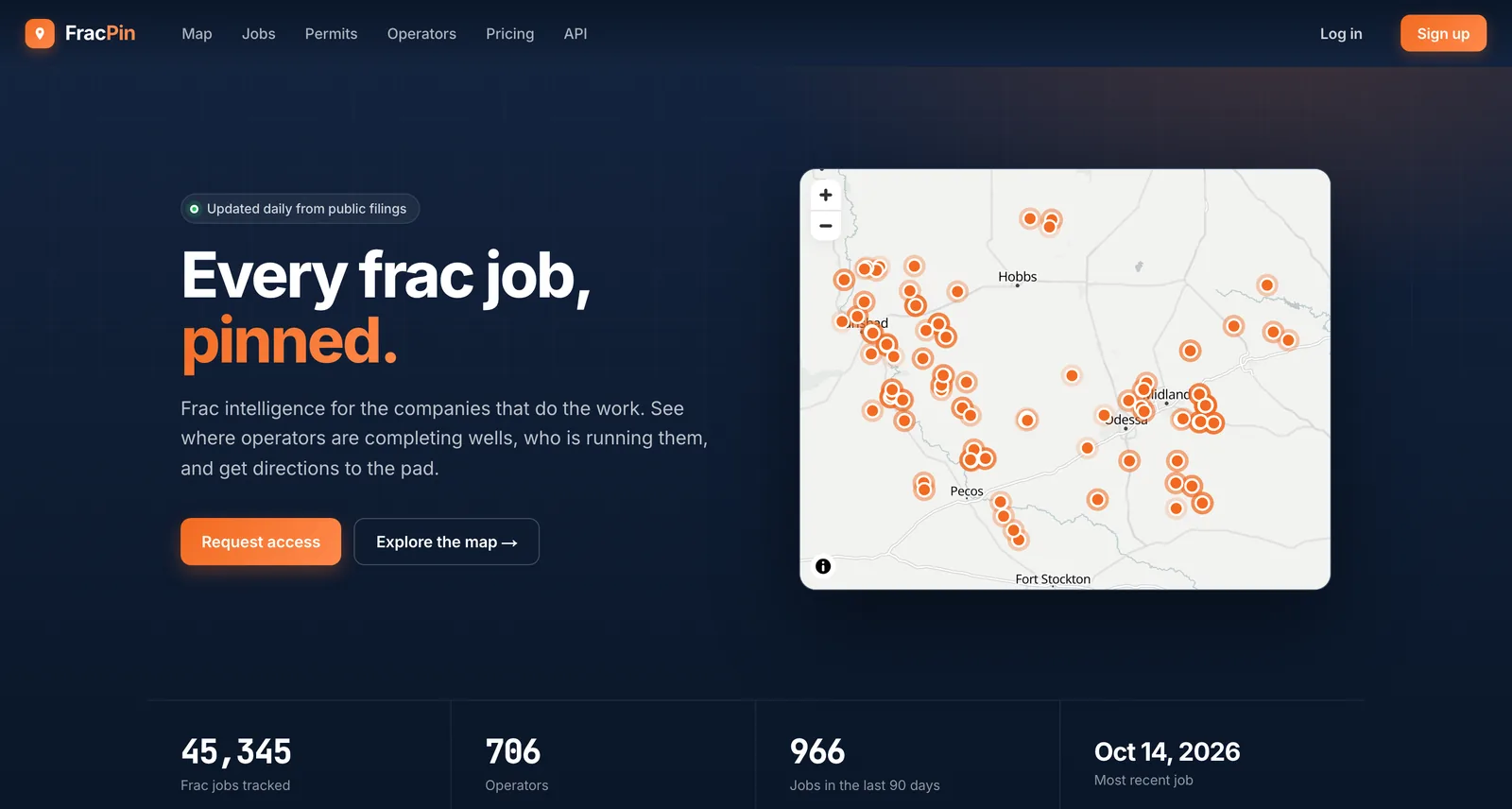
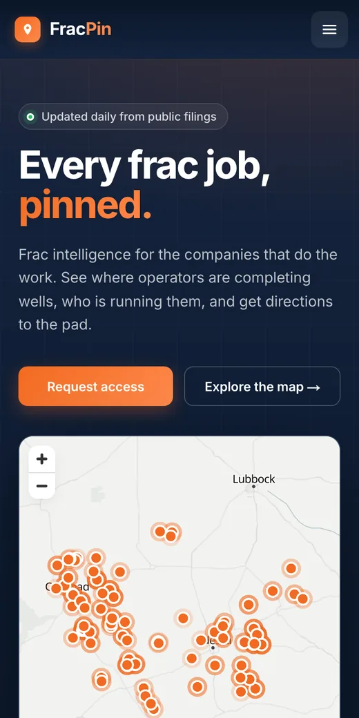
FracPin
Active frac & drilling site sales leads, territory mapping, daily lead updates & analytics.
Foremost a sales lead and territory intelligence platform using active frac and drilling sites to map territories, deliver daily lead updates and analytics, and navigate to remote pads.
Visit fracpin.com ↗Live System Portal
Tell us about your business.
Front Facing Website
Agency: $18,500 + $1,200/mo
$797 + $197/mo
You save $17,703
Front Facing Website + Back End Portal
Most chosenAgency: $45,000 + $2,500/mo
$1,497 + $397/mo
You save $43,503
Questions, answered.
How does the instant quote calculator handle custom variables for land surveying & drone lidar mapping?
We map your exact pricing rules around parcel acreage, boundary corner count, survey type (ALTA/NSPS commercial, rural boundary/stakeout, topo, or drone LiDAR photogrammetry), and deed status into 4 simple questions—showing customers an honest Good/Better/Best ballpark range and collecting a 1-tap deposit.
Where do the 6:00 AM daily leads for land surveying & drone lidar mapping come from?
Your private Lead Finder monitors County Rural Acreage & Commercial Escrow Title Company Survey Order Feed, Municipal Subdivision Plat, Civil Engineering & Excavation Contractor Network, and FracPin.com Live Field & Territory Intelligence Feed (Land surveying & drone LiDAR mapping) every morning so you reach high-intent prospects before competitors.
How fast can we launch our custom land surveying & drone lidar mapping system?
Test your interactive preview right on this page in 60 seconds, review your custom-branded build within 72 hours, and launch for $297 setup + $79/mo (Self-Startup) or $797 + $197/mo.
See exactly what we'd build.
One question at a time. Your tools, timeline and price at the end.
Build My Custom AI System →Related: Custom lead generation · AI receptionist · Instant quote calculator